Profile from Surface
The result of Profile from Surface is a Profile Element with a relationship to the Terrain. If the terrain changes the profile updates.
|
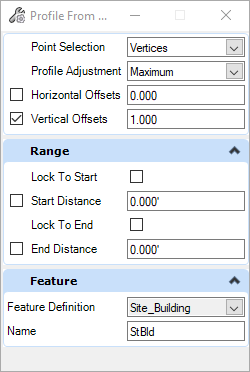
The tool creates a profle "linestring". It gets the horizontal vertices from the horizontal element and creates vertical vertices from the controls in the top group of the dialog. The Profile from Surface dialog has three important Modes: Point Selection - Where do you want controlling vertical elevations?
Profile Adjustment: do you want the line to be a constant elevation at the highest or lowest found elevation?
Vertical Offsets: this value is added to the vertices values calculated by the above settings.
The settings shown is good for a building pad. It will place a level profile 1 foot above the highest ground elevation found at the corners of a horizontal shape. |
 |
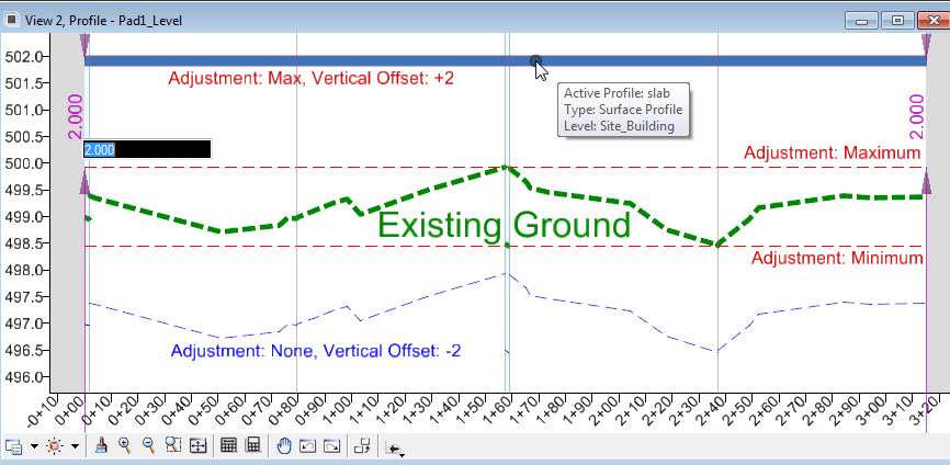
The image below shows multiiple Offset and Adjustment options of a square shape with the Point Selection set to ALL

Note that these settings are editable in the Properties dialog
